
Yellow and faded, securely attached to a piece of heavy cardboard, it just barely fit on the flatbed scanner. How and when did my grandmother come into possession of this picture? Well, that's a good question. In that box from my uncle, there were also some pictures of Thornton Brubaker and his family as well as several of the children of Samuel Brubaker. They were John's sons and half-brothers of my 2nd great-grandfather, William Brubaker. My guess would be that whomever gave her those pictures also gave her the picture of John's residence. Wherever she got them, I'm sure glad she kept them!
I've seen the "Combination Atlas Map of Huntington County, Indiana" published in 1879, but I don't recall seeing this image in it. Yesterday, I decided to see what other atlases had been published in the late 1880s. The first thing that came up on Google search was a hit on the David Rumsey Collection! Turns out, the image above was printed on page 125 (center of page, left side) of the "Illustrated Historical Atlas of the State of Indiana" which was published by Baskin, Forster & Co., Chicago, 1876. Engraved & Printed by Chas. Shober & Co. Props. of Chicago Lithographing Co.
What is great about it being in the David Rumsey Collection is that you can zoom in and enlarge the pages. The detail in the images on the Rumsey site is incredible. A map of Huntington County is on page 66 of the atlas. The "homepage" of the atlas shows that there are 187 images covering all 92 counties of the state.
Thanks to an unknown benefactor many years ago, my grandmother, and my uncle, I have a very nice piece of my family history. One of these days I'm going to make the trip to Huntington County (it's only about a 40 minute drive) and see if I can find his farm. I doubt that the house is still standing, but it's possible...
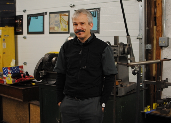 For those who are not familiar with Mike Flanigan, I do not think it is an exaggeration to say that he is a legendary figure in the bicycle industry. Not only does A.N.T. put out a truly unique product, but Mike's background is impressive in itself. He started out in 1989 at
  Since discovering A.N.T. a year ago, I keep asking myself what exactly makes these bicycles so interesting and unusual? Others make TIG-welded frames. Others offer custom colours. And now that the concept of "city bike" has taken off, others build up bicycles designed for fenders, front and rear loads, and upright sitting. So what does A.N.T. offer that's different?
 Ah yes - Personality. And I am not talking about Mike's own great personality. The
  And then there is the fact that Mike himself is a kind, generous and creative person, who sticks to his principles and follows his philosophy. It is endearing to hear the younger framebuilding generation in the Boston area speak of him. Everyone seems to have a story about Mike having helped them out at some point, or taught them something; he is somewhat of a patron saint around these parts.
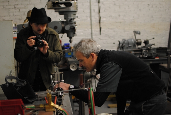 So that is the man we had the privilege to photograph last week, and we thank him for the opportunity.
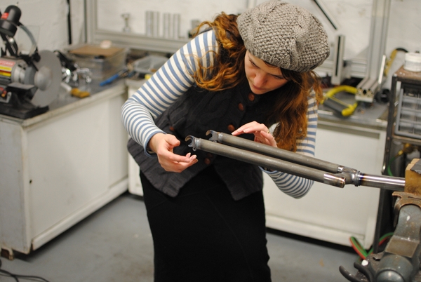 I enjoyed looking at all the tools and machinery in the A.N.T. workshop, and more than anything I loved examining this fork. It is a segmented fork that I believe goes on the Light Roadsters. There is something about the look of these that I find very cool.
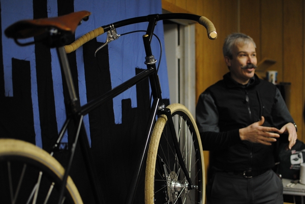 Here Mike explains something to the Co-Habitant, as his Antique Scorcher poses in the foreground. To see some of the other bikes A.N.T. has made recently, have a look at their flickr sets. I wrote a test ride report of a Boston Lady's Roadster here, and I think the latest series of mixtes (especially the gold and the white one) are particularly beautiful. And of course I am very curious to see what Mike will be building for the North American Handbuilt Bicycle Show . I think he knows what my fantasy A.N.T. bike is, but that is another story entirely!


 It looks like we are starting to have a bit of spring. The willow trees are greening up. The ornimental pear is blooming although the flowers are windblown, and my cottonwood trees are blooming their strange little, 2 inch long yellow blossoms.
 This photo was probably taken about 1890: back row, left to right: John Ernest, Sophia (Phend) Ernest, Samuel Phend, his wife Mary (Laudeman) Phend, Jacob J Phend, his wife Louisa (Grimm) Phend.front row, left to right: John Phend, his wife Mary (Rarrick) Phend, Jacob Phend, his wife Louisa (Fisher) Phend, Christian Phend, his wife Mary (McConnell) Phend. Seated in front of his parents is Henry Phend.
 Casa Grande Peak, looking back on the trail, about a quarter of the way in. This was one of the easier stretches. Thank goodness it wasn't all uphill all of the time!
 From the halfway point, looking south. Views like this is what made the trek worthwhile!
 And this! The view from the top! Casa Grande on the left. The “v” shaped area is called the window, for reasons I'll explain later. The Basin is the low area in the center and is where the campground was located. The white ribbon streaking through the center is the road leading to the Basin and the Lodge. The Lost Mine Trail began about where the road disappears in the center going toward the Basin.
 A zoomed-in shot of the Basin and campground.
 Heading down. Again, this is one of the easier sections of the trail. Lots of switchbacks. Lots of rocks. Going down took almost as long as going up. It was also harder on the legs, but much, much easier on the heart and lungs! After 4.8 miles and 3 hours I felt tired, for sure, but also exhilerated. It was my first “long” hike, and I made it back safe and sound.


 Behind the church in Old Town is a very big, old cottonwood tree. About 10 feet up the tree is a tree bole as is common in cottonwoods. Someone had taken the time, and talent to carve a old-style catholic saint, (I guess that is what it is as I am not catholic and not into the old art that much.) I do know it is very unique.


 regular cars and pickups.


 It's not every day that one meets a cartoon character, let alone a bicycling cartoon character. And so imagine my delight upon learning that I live just minutes from one. Allow me to introduce:Bikeyface!
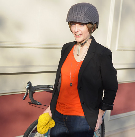
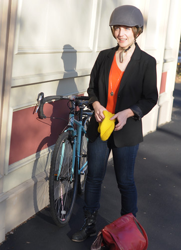 The heroine of Bikeyface describes herself as a "common commuter" type - who wears "non-spandex" clothing, "inappropriate cycling footwear," a hounstooth patterned helmet, and a "bikey smile" as she pedals around greater Boston on her bike, Marlene Dietrich.
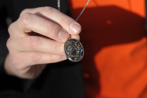 Occasionally she will don a cycling-themed accessory, such as this gear pendant (okay, so they're the wrong type of gears)...
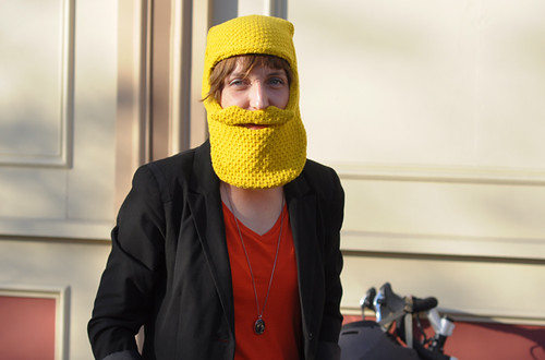 ...or a beard/muschachio balaclava, to compensate for her lack of facial hair on chilly winter commutes.
 But who is Bikeyface really, the woman behind the cartoon and the knitted facial hair?
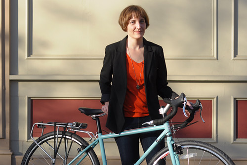 Well, all right: She is Bekka. She is a painter with a non-painterly dayjob, to which she commutes by bike. She lives in Somerville, MA. Before that she lived in LA and rode her bike there. And she is from New England originally.
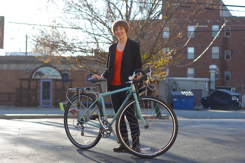 The bike she currently rides is a tiny Surly Cross-Check in her favourite colour, which she got last summer and loves. It is called "Marlene Dietrich" because it is sultry and feminine, yet with a tomboyish edge. Of course. Other bikes she has owned have included an Electra Amsterdam and a couple of hybrids, but Marlene is the preferred ride - used for both commuting and long distance recreational cycling.
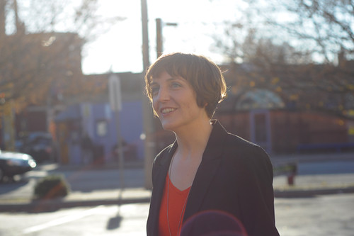 Of all the people I've met so far via the cycling blog connection, meeting Bekka has been my biggest "the worlds collide" type of experience. Besides living walking distance from one another, we discovered that we have some uncanny non-bikey things in common and spend more time talking about those than we do about cycling. It sometimes feels as if we are interacting as two different sets of people: the real us, with our bikey alter egos hovering in the background. We've talked a little about identity - how we both come across differently on our blogs than we do in person, and how people react to that difference when they meet us. Whereas Bikeyface is a perky, mischievous and boisterous character, in person Bekka is subtle and analytical, and rather difficult to characterise. Visually, she is striking: A soft and delicate face withenormous, unusually shaped blue eyes - the type of face that belongs in a 1930s French film and not so much in a 21st century bike cartoon. I would certainly like to paint her some time, as herself.