Monday, February 27, 2012

Spring at Pancake Bay


This is one of my favorite shots from Memorial weekend. Taken on Sunday evening, there were some really nice clouds at sunset that night. After the sun went down we could hear thunder rumbling in the distance and as darkness fell over the lake a nice little lightning show was visible out on the horizon. After the two previous evenings which were very dismal shooting conditions (rain and gray, cloudy skies), Sunday evening more than made up for it with some of the most spectacular spring sunset clouds I've ever seen. The island on the left is called Pancake Island, and the one in the distance is called Blueberry Island. My buddy Roger refers to them as "The Breakfast Islands" (think blueberry pancakes!).


Saturday, February 25, 2012

Big Lagoon State Park

Located 10 miles southwest of Pensacola, Big Lagoon State Park is named for the lagoon bordering a portion of the northern shore of Perdido Key. Compared to some Florida state parks, Big Lagoon is on the small side but it has several nice trails and admittance to it also gives you access to two other state parks in the area. I loved the campground. Most sites were large enough to accommodate a bus-size RV and there was some degree of privacy with shrubs and trees separating most sites.

My first day there (Wednesday, February 3rd) was beautiful, until late afternoon when the clouds rolled in. It rained that night and for most of the next two days. My neighbors lost the rain-fly of their tent one night, blown off by the wind. They and everything in the tent got soaked. They were not happy campers ;-)

The campsite. The Picnic table and fire ring are hidden behind the van.

Taken on the first day at the park.

The lagoon and marsh area. Also taken on the first day.

Towards sunset on Friday the sky started to clear and I was hopeful that there would be some sunshine the next day, but it was not to be. It remained cloudy and overcast for two more days.

It was still rather cloudy at 5 o'clock on Friday.

But by 5:25 most of the clouds had been blown away by the wind.

Wednesday, February 22, 2012

Blue Swan

This blue swan was in mothers things and I think it may have been my grandmothers. There are no marks on it at all. It may be some sort of pottery or china. Maybe a candy dish or soap dish or for jewelry or pins.

Monday, February 20, 2012

Access, Openings, and the U.S. Army

Opportunity knocks with the park virtually closed. Over the past three weeks, I attended an emergency medical course with the U.S. Army at Ft. Lewis. Beyond the obvious benefit of training, it was a privilege to spend time with our soldiers. The training also explains why there have been few updates to the blog...

I continue to get questions about the best way to access the mountain (i.e. Paradise). For all practical purposes, getting to Paradise is almost impossible. Why? Because there is NO public access allowed along the road corridor above Longmire. That means if you have a trip to Paradise planned for later this winter or early spring, scale back your access expectations and consider other locations.

Access to White River isn't that bad, if you have a snow machine. One party rode into the campground, parked, and then snowshoed up to the Inter Glacier. To the right, a snowboarder breaks trail through Glacier Basin (image by Don Boutry). Perhaps some climbers will follow suit? And while we're discussing access to White River and Sunrise... the current thought is that the projected road openings will go as planned next spring. This is welcome news considering the delayed openings on HWY 123; it was totally severed and may not be fully repaired and re-opened until next fall!

Last week, NPS rangers discovered more facility damage to a few of the fire lookouts. Here is Fremont Lookout from the air. Note that the roof is missing. Similar damage was found at Gobblers Knob (the roof blew off and a wall collasped) but Tolmie and Shriner (the other lookouts in the park) survived OK.

The current talk points to an April 1st road re-opening to Longmire. That would make access to the Westside Road easier and more reliable. As for Paradise, they are cautiously predicting May 1st...

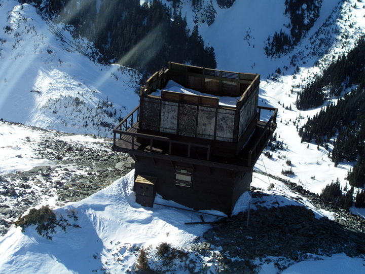
As for repairs, they just paved the road at Sunshine Point. Meanwhile, the road crew is installing more culverts at Kautz Creek. Another engineering obstacle remains at milepost 5, where the uphill lane is slumping towards the river. It may not look like much in this photo, but the embankment below is severely eroded by the Nisqually River.


You may have noticed that I am now managing the photos on Flickr and have finally started posting images in the flood folder. But using blogger for this purpose isn't that easy, so we'll see how much I can do with it...

What's for Dinner?

Ya, no, not what you are thinking.

Dinner as in "dinner plates", the kind you get on hard, cold ice and can reap some havoc even if you are careful.

Most of us have been cut at one time or another. Some have had stitches or just as likely should have had stitches and didn't. I've been knocked out cold, by a dinner plate while leading...imagine that!?


So we wear helmets. But in addition to the helmet there is something else I used to make fun of now I doubt I'll ever climb ice again without one. It is the visor. Couple of companies offering them in different versions. Easiest one for me to get my hands on was a Petzel.

Last year I popped a small piece of ice directly into my eye on a hard lead. Big enough piece and high enough velocity it bruised my eye ball just off the lens. Scared me a bit honestly, since my eye sight is much of how I make a living. That and the fact it hurt bad enough I couldn't open my eye, let alone see out of it, for several minutes. That while hanging on tools in the midst of a serious lead for me. A sore eye ball for several more days after that trip kept up the reminder. So I found a visor this summer and added it to my Canadian ice gear list. Still not convinced it was worth the effort on local ice. Then on the last trip the visor deflected a fist size piece of ice bound for my chin that I never saw coming. Decided by now that the visor is a good thing on any ice. Bit hard to pack around but easier than expected so far. It is a gimmick...and I hate gimmicks but this one really does work and worth the silly price tag imo.


A new one on me was having a dinner plate smack me in the foot this trip and dang near break a toe. Never would have imagined! The purple toe nail pictured below is a week old now. I will obviously lose the nail in time. Didn't hurt terribly bad at the time although I did notice the smack while leading on a pillar of hard ice. But...WOWIE..was it sore the next few days afterwards.


Not that big a piece of ice either. I would have thought my boots would have protected me more. No mark on the boot but with some inspection of the boot toe it is easy to see a big piece of ice could collapse the boot enough and damage your foot. You have to be careful out there :)


Just helps to be aware of what could happen in lwt boots. If this incident (my first in 30+ years of waterfall ice) is any indication a broken foot is not out of the question with a well planted crampon and a big piece of ice.

Leavenworth ..

Adam and I went out to practice crack climbing in Leavenworth. The original idea was to climb Givler's Crack and do laps on the first part of the second pitch. However, we decided not to do the longer walk and split our time between Gibson's Crack and Dogleg Crack. We got a late start and poked around the canyon a bit before starting as we wanted the sun to warm things up a bit.

I had climbed Gibson's a few years ago, but followed Ian. This time around I wanted to lead it. But I started at the lower start and had placed two pieces in the upper section before I was half way up. Since the crack is fairly uniform in width, I got concerned that I wouldn't have gear to place higher up and bailed off. We set up a top rope and did a few laps each with the obvious crux at the top of the route. My first time through the crux was not pretty and the second time was just fine. I lamented to Adam how this sure gave me a lot of trouble being only a 5.5. I told him I have no problems on the 5.7 Givler's. Which I guess means it was good that we came out and did this as I would rather work on climbs that are giving me difficulty.

Gibson's Crack

After a short break for lunch, we drove over to Dogleg Crack. We hiked around and set up a top rope. I had tried to lead this route last season, but backed off when I found the gear to be almost as difficult as the climbing. I went first, and sort of remembered the moves through the crux, but couldn't seem to sequence them. I lowered off without getting passed it because I was tiring and hanging in the Bod harness was not so comfortable.

Adam gave it a go and was able to struggle his way through the crux before going into an awkward lieback before the climb eases a bit. He hit his high point moments later on the thinner finger crack section and I lowered him because he was pumped. I got back on and struggled and hung through the crux before completing the rest of the pitch with a little fall at the dog leg.

Adam on Dogleg Crack

We were both pretty tired but decided to climb Hind Quarters next to Dogleg. At the crux, our top rope was pulling us too far away from the route to finish, so Adam played with the finger crack a little bit before lowering off. I gave Hind Quarters a go and found myself to be quite tired but at the crux bailed back onto Dogleg to finish. I made my way up for the last time to clean the anchor and walk back down.

It was a strange day as I expected to have a positively easy time on Gibson's Crack and not struggle as badly on Dogleg Crack. I think my previous effort with Lori on Dogleg Crack was aided by taping my hands. I hate to admit that it made that much of a difference, but I really beat up my hands yesterday and struggled more than previously. So it appears to be an obvious connection.

Sunday, February 19, 2012

Observation Point

The guide for the Observation Point Trail states “This is a long strenuous trail with many steep sections and unprotected drop-offs. Not for anyone who is out of shape, or has a fear of heights.” An apt description, I might add! It ascends 2,148 feet in four miles, making it an eight-mile round-trip. Observation Point provides another view of the Zion Canyon, including Angels Landing, from above.

When I was about one-third of the way up, I began to be passed by small groups of kids. They just kept on coming. And passing me. Finally, several of them had stopped to take a break and I took that opportunity to talk with them. There were 63 kids (ranging in age from 11 to 13) and 12 adults from a satellite school in Houston, Texas. They had been at Zion for eight days and had gone on a hike every day, each hike being progressively more difficult. The day before they had ALL made it to the top of Angels Landing! In fact, each and every one of them had completed every hike they had done. Pretty impressive. However, I was extremely glad that they weren't doing Angels Landing at the same time as I was. It's not that they were terrible kids, because they were the most well-behaved group I think I've ever seen. It's just that there were so many of them!

A short time later I began to play leap-frog with a fellow, probably in his 30s, and asked if he was with the group of kids from Houston. Turns out he was the husband of the principal. We talked for a while as we slowly walked along the trail. He told me that each of the kids had earned their way during the school year by “doing the right thing” as much as possible. They have a system using baseball as an analogy, hits for the good things and strikes for the not so good. Sixty-three kids had enough “hits” to make the trip while 42 were back in Houston.

Anyway, by the time I got to Observation Point I had been passed by nearly everyone in their group, as well as a few other hikers. But I got there! And again, the views from the top and along the way were well worth the effort.

Part way up the trail, eyeball to eyeball with Angels Landing (with the help of the 7x zoom). It doesn't look quite so “bad” from this angle.

After you go up a series of steep switchbacks you enter a narrow canyon that has a stream running through it, but there wasn't much water actually flowing. This was one of the neatest parts of the hike, in my opinion!

There were pools of standing water but we didn't get our feet wet.

The sky and the walls of the canyon are reflected in one of the pools of water.

This was taken on the way back down, entering the canyon from the east.

The trail has exited Echo Canyon and is progressing up the east side of the canyon wall.

I'm still going up, but they are going down.

The destination, Observation Point, is just above the red “lines” in the center.

This last uphill stretch seemed never-ending.

Finally, the plateau. But there is still a ways to go to get out to the point.

Part of the group of 63 kids. A very well-behaved group they were.

The lower portion of the trail, coming up out of the Zion Canyon floor. The Observation Point trail goes off to the left (top center of photo). The three topmost switchbacks belong to the Hidden Canyon Trail, which goes off to the right.

The top of Angels Landing ranges from 20 to 40 feet in width. There are people up there...

As I was promised by my camping neighbors, Maryann and Rob, the view from Observation Point is spectacular. The Virgin River flows through the valley, Angels Landing is in the Center, and then the eastern wall of Refrigerator Canyon. Fantastic.

Petzl ERGO


Ueli Steckon the m6 Direct Startto the Super Couloir.Jon Griffin photo and link here:


http://www.alpineexposures.com/blogs/chamonix-conditions/1438782-its-been-a-long-10-days


The original Ergo was one of the new tools that started the mixed tool explosion. That was several generations ago now and it is obvious that dbl handled tools are here to stay. Once thought an esoteric in design and for the specialists only it became a pretty common place design along with the BD Reactor and other newer tools from a few companies playing catch up.


Then the Nomic came out. Even more radical in design and appearance it didn't take long for almost everyone to realise just how good the Nomic was and how much easier it made ice and mixed climbing. The radical shaft shape and lack of hammer didn't stop the Nomic users from getting on everything from easy alpine ice to hard M8 all with the same tool. And amazingly almost everyone happy with it!


The newest Ergo is another big jump in shaft and handle design. You now have an extremely high clearance shaft and the option of three supported hand positions.


To be honest I am still learning how to climb on a Nomic after 5 seasons and figure I have yet to fulfill its potential.


The new Ergo is a big step up on the Nomic's potential from what I first see, visualise and can act upon even now.


Another look at the new Ergo here with good pictures:


http://rafalandronowski.wordpress.com//02/12/petzl-ergo-at-haffner-creek/


More here from someone who can actually use the new Ergo as intended:


http://machavok.blogspot.com//10/petzl-ergo-mixed-climbing-tool-review.html


In the grand scheme of the Ergo I am a gumby climber. But then I am a gumby as well when you look at who the Nomic was designed for. It is a true stroke of genius to have a tool like the Nomic that climbers at any skill can take advantage of. The question is can a gumby take advantage of what the Ergo has to offer and will it up your game over the Nomic?


For what it is worth the Ergo is an amazing piece of kit even for a beginner on mixed. Easy or hard terrain and with no concern for your climbing ability imo the Ergo is a rather big step up in performance over every previous ice tool I have used. There is little question it really excels on vertical terrain, mixed or ice. But you can just as easily climb Grade 3 water ice with the Ergo as you can with an original Quark or a Nomic for that matter. The more horizontal grip of the Ergo really has a grip strength advantage over even the Nomic'c excellent grip profile. Enough so that the Ergo's grip kept me on a climb that I should have and would have blown off an Nomic's grip when I popped both feet trying to get onan icicle while coming off mixed terrain.

The new grip angle is a big advantage on difficult terrain and doesn't seem to have any down sides or easy terrian that I can tell. It is easy enough to move your hands up the shaft as the terrian looses angle. The other big advanatge I see form the previous generation of Nomics is the serrated lower grip pommel. The serrated steel blade really does offer good bite on the ice and makes the tool much more stable. More so than I ever thought it would. Big plus here. Down side is the Nomic and Ergos pommel attachment design is seriously flawed and is prone to quick failure. Which makes the tool pretty worthless.

I really like this tool. Much more so than I had ever envisioned. It works very well on any mixed or pure ice terrain. Even the easy stuff and is exceptional on the vertical stuff. I can see this being the only tool many climbers will own and they will be satisfied by doing so.The only down side from a huge positive recommendation for a beginner wanting to climb harder and get better, tothe proficienthard core mixed master, is the poor pommel design that Petzl is obviously going to have to fix sooner than later.

But there is enough advantages to the new shaft design that I am going to figure out a away to make my set of Ergos reliable enough to take ontosome serious alpine mixed terrain.

(see the other post for the details on the Nomic Ergo"failures")

Friday, February 17, 2012

Snow time...

Quite a bit of snow has fallen over the past week leaving plenty at Paradise (a solid 2 feet). As you can see in this John Piastuck image, skiers and boarders (32 ants by my count) are "chomping at the bit" to climb Panorama Point for early season turns... This is looking to be a very promising ski season folks. The question is, will it hold; will it continue?

The Washington State Climatologists have something to say about our weather. They just published an
interesting report about our 2007 summer temperatures. It points to data that says we're still experiencing a warmer than normal trend (0.01 to be exact for Aug). I also found that they are willing to post an "Outlook" for the fall and winter. Check it out, but don't look for any clarity as it doesn't really predict anything substantial or exciting: "The Climate Prediction Center's 3-month outlook for November-December-January is for equal chances of above, below, or normal temperatures for Washington..."

Whatever the case, we're off to good start and the ants on Pan Point are seemingly stoked. With them are a few climbers who are hoping to find the summit this week. Perhaps they'll successfully weave through the upper mountain crevasses and visit Columbia Crest during this weather window.

If you are planning to climb this fall, here are few safety, registration and camping tips:
  • Expect crevasses: Though it's been snowing quite a bit this Sept/Oct, be prepared for lightly covered crevasses on the mountain.
  • Avalanche: Yes, slides have killed climbers in the fall on Mount Rainier and it could easily happen again. It doesn't take much to knock a team into a terrain trap (crevasse, cliff, hole) or bury someone. This is especially the case if the wind is blowing which could contribute to large snow deposits.
  • Poor weather: Ok, this is a constant on Rainier, but fall is definitely the time when storms linger longer than expected and climbers regret their "fast and light" plans. Be prepared to sit out inclement weather and expect heavy wet snow.
You can register in Longmire at the museum, or self register (i.e. honor system) at Paradise on the front porch of the Jackson Visitor Center. Most teams will select the Camp Muir Public Shelter for high camp accommodations. Over the past few years, that hut has been very accessible... But you should still bring a shovel to dig out the door and always clean up after you leave. On nice/busy weekends, bring your ear plugs (snoring, running stoves, chatter) and expect to breath stove exhaust in the hut.

Sunday, February 12, 2012

Mystery Photo #8

This is the seventh post (and 8th photo) in a series of unidentified photographs from the Charles Wiseman Family Bible. See this post for background information. Click on the "Mystery Photo" label at the bottom of the post to see all of the photographs in this series. As always, you can click on the pictures to enlarge them.


Paper photograph on card stock. 2 3/8 x 4 1/16. Printed on back: Frank A. Place, Photographer, Warsaw, Ind. Also, perhaps, another of those "hidden mother" photos? Looks to me like the background has been retouched.

Okay, even though we all know what can happen when you assume something, an assumption is going to be made that this is a photograph of one of the grandchildren of Charles and Susanna Bray Wiseman. In the previous post I suggested that the baby in that picture was Nathaniel Howard Wiseman, born July 18, 1884. He was the 2nd grandchild of Charles and Susanna. The first was Ethol Walter Scott, born April 7, 1884 in Vevay, Switzerland County, Indiana and the son of Susanna Wiseman and James Scott. I don't think the previous picture was of Ethol because they lived in Vevay, in the southeastern part of Indiana. It's my opinion that the above photograph is of the 3rd grandchild who was Charles Wilson Wiseman, born September 20, 1886 and the son of Amanda Alexander and Samuel Bray Wiseman though it could be Smith Wiseman, born February 27, 1888 and also the son of Sam and Amanda.

The pictures below are from my father and were identified (from left to right) as Ethol Scott, Howard Wiseman, Smith and Charles Wiseman.

Friday, February 10, 2012

Where Do You Want to Go, Really?


I was telling a local cyclist about my dream bicycle tour, one I've imagined for years. It is still a matter of wishful thinking for now, but nonetheless I've mapped it all out: 650 miles of cycling up the coast, from the North Shore of Massachusetts to the easternmost tip of Downeast Maine. The coastline is jagged there and hugging it makes for a decidedly circuitous route. And my plan is to hug every curve - to not let the ocean out of my sight if I can help it. The cyclist I was talking to - an experienced bicycle tourist - said that the logistics of my plan sounded solid, but that it seemed like an awful lot of work for such a bleak destination. Do I realise how stark and desolate that area is? The picturesque Maine everyone envisions - with its seaside farms, historical houses and sandy beaches - is actually in the southern part of the state.There are some popular scenic New England routesthat I might want to consider instead.


In fact my choice of route is deliberate and I know exactly what that area is like. Still, I am taking the warning seriously. Often we imagine what we think is a dream destination, only to learn that it's not that great to actually cycle there. It can be a matter of traffic, of overly challenging terrain, of insufficient amenities, or even of scenery that, while beautiful, becomes unexpectedly monotonous at bicycling speed. Or maybe our memory of a place focuses on one specific spot that is stunning to visit, but glosses over the fact that the route to it is in itself unremarkable. I have had these experiences on local rides, so I can certainly imagine the disappointment on a long tour. After all, a tour is something we need to to plan for, take time off work - we want it to be special and worth it.


So how can we tell where we want to go, really? Reading others' ride reports of the route we are considering might be helpful. It's also worth paying attention to what we personally enjoy and don't enjoy about the cycling experience. I know that I prefer rough scenery to the more manicured postcard-pretty stuff.I like sparsely populated areas.I love to see bogs overgrown with green algae, dilapidated barns, ghostly forests. I don't mind badly maintained roads. I prefer as little car traffic as possible and am willing to pay for the backroads experience by climbing extra hills. I do not grow bored of looking at the ocean. But I also cannot ride for long in direct sunlight, and I know that coastal routes tend to have much less shade than inland routes. It's hard to say whether my hypothetical dream ride along the Maine coast will be enjoyable in practice. But it's nice to dream for now.


How have your dream bicycling destinations measured up against reality?

Out With The Old


One after one they fall, those old dusty places that no one will ever be able to replace because they belong to another time. The Market Inn is the latest casualty in the name of progress. I know I'm a little weird attached as I am to the rock holes and relic type restaurants, but I also recognize that history is being obliterated, and that the value of these lost places has no price tag. (Well, maybe pieces of it have a price tag which is why I was able to liberate the upright piano when the Roma auctioned its contents. It's a great old work horse that needs to be put out to pasture according to Bobby Birdsong, but I can't bring myself to do it and so it sits, moldering in my living room- still reeking of cigarettes on hot summer days.) The Market Inn auction is later this month.

The new trend towards reviving the town center is a good idea, but how did we stray so far from the originals? Silver Spring and Hyattsville were towns in their own rite, but now their new "down towns" have an interchangeable feel. And I just can't imagine people working their whole lives in a Baja Fresh as they did in the old family run places. Hyattsville now boasts an arts district which is a great idea, but part of this includes the most sterile "urban row homes" to house bohemia that I've ever seen in the new town center behind PG Plaza. Somebody needs to go in there with a case of spray paint. And I doubt any of the new restaurants will be collecting nudes, or full suits of armour or hunting trophies like they did in the Market Inn, the Orleans House and The Roma. Ulysses Auger, of Blackie's House of Beef once built an annex called Lulu's which was dedicated to his wife's one time experience as a Queen of Mardi Gras. Now that's what I call a theme restaurant!Sprinkled here and there the old and odd places are still clinging to life- like Tastee Diner, Crisfield's, Vincino's and god bless Roger Miller's African Restaurant. Franklin's is a great blend of new and old- housed in an old hardware store and serving some of the best beer in the area. And one of my all time favorites is The Hitching Post where you can get a fried chicken sandwich which boasts at least 5 pieces of bird and almost as an afterthought two pieces of Wonder bread on the side. Here's a picture of my mom on her ninetieth plus birthday ( you heard me) and her chicken sandwich. It just doesn't get much better than this.

The Virtues of Versatility

Bella Ciao, BostonFor a couple of months now I've been riding only one bicycle for transportation instead of switching between several, and I've got to say that I like it. Not only that, but I am realising that strictly speaking, the others I own are not really necessary, as this one is sufficiently versatile to do everything I need. I've never felt this way toward another transport bicycle before, which is why I've always had multiples: at the very least one IGH bike for local errands and winter cycling, and a lighter, derailleur-geared bike for long distance trips with hills. But now that division of labor is no longer neeeded.

The bicycle I am riding is a modified Bella Ciao Donna that Ifinally have all to myself againafter it served as a guinea pig for a project I was working on. It is not perfect at everything. My other transport bike is a vintage Gazelle and it's a cushier, more luxurious ride with greater carrying capacity. I also have a Royal H mixte that is faster, lighter weight, easier uphill, and equipped with better lighting. But the Gazelle cannot be ridden long distances efficiently. And the mixte cannot be ridden in the winter, plus the frame can be a pain to mount and dismount in some outfits. Neither of the two would work as an "only bike." But the Bella Ciao can handle long distances, does a decent job of tackling hills, is suitable for winter, and accommodates any outfit.The 3-speed drivetrain keeps things simple. The powdercoat and chaincase keep it maintenance-free. The handling has a distinctly vintage feel that is not for everyone, but works well for me.Sure I've wished for more cush over potholes, more cargo capacity and more gears while riding this bike. But I can count on one hand the number of times that has happened over the past two months.

Versatility is not an exciting characteristic, because it implies compromise. "Jack of all trades, master of none" sort of thing. But I guess for transportation cycling I am finding that the jack of all trades is winning me over - at least for the time being. More than anything, I think the trick is finding that sweet spot of a bike - what one person considers versatile may not be sufficiently versatile for another. But if you do find one that does it for you, it can be such a relief!Getting around on the same bike regardless of destination has simplified my life considerably, giving me a new appreciation for versatility.

Thursday, February 9, 2012

A Change of Scenery

Magilligan Point, Lough Foyle

On the day of my arrival, the temperature reached a scorching 68°F and the sun came out for the entire afternoon! Yes, summer is in full swing in Northern Ireland. I have relocated here temporarily - to the countryside along the coast, not far from the city of Derry and the town of Limavady. As I write this, a sheep is looking over my shoulder. A mountain looms in the distance. And the breeze is so gentle, I am almost tempted to remove my wool blazer.


What am I doing here? Mostly two things: writing and riding. I've brought over my roadbike and I have a Brompton on loan from the lovely Chris Sharp. The nearest town is 3.5 miles away. The nearest mountain is just around the corner.


The food situation is pretty straightforward. There is plenty of fish in the Lough Foyle and berries in Ballykelly Forest. In a pinch, there is also the Tesco down the road.


I am still getting my bearings after 2 days of no sleep, but posting should be pretty regular. The wifi is fired up and working splendidly, so long as I add coal every half hour or so.


Later this afternoon I am off to watch a time trial. What more could a girl ask for?

Monday, February 6, 2012

The Berlin Family :: Introduction to The Letters

John D. and Susannah (Huffman) Berlin are my 3rd Great Grandparents. I've been researching them, their children, and their descendants off-and-on for nearly twenty years.


John D. Berlin and Susannah (Hoffman) Berlin.Photographs from the Solomon Berlin Family Bible.In possession of Carolyn Gentzhorn Rensberger in 1997.

In 1995, while visiting the Public Library in Nappanee, Elkhart County, Indiana I “discovered” a collection of old letters that were on display. Somehow they had been overlooked on previous visits. These letters just happened to be from "my" family! Most of them were written to Elizabeth “Lizzie” Berlin Coppes, sister of my Great-Great Grandmother, Lovina (Berlin) Yarian.


There were thirty-five letters written, starting in 1862 and going through 1871, then there is a twenty-year gap with one letter from each of the years 1892 and 1895. The letters were donated to the Heritage Room of the Nappanee Public Library by Elizabeth's granddaughter, Helen Mutschler Chapman (1902-1990).


The Library allowed xeroxcopies of the letters to be made, and after a considerable amount of time spent in deciphering them, they were transcribed and posted on my (now defunct) website. I'm posting the transcriptions here on the blog so that they remain available to descendants as well as to other researchers. Images of the letters will not be included here due to the fact that many of the copies were of poor quality. And, also, although I did obtain permission to publish transcriptions of the letters, I never received permission to use images of them.


Every attempt was made to present the letters as they were written, including “errors” in spelling and grammar. However, some punctuation and many paragraphs breaks have been added to help improve readability. Many of the letters were one continuous sentence with little or no punctuation to separate thoughts, hopefully I've made the “breaks” at the right spot! The writers also often wrote in the margins in an attempt to use as much of the paper as possible. Some of the letters were very difficult to decipher.


There are several letters written by soldiers on the front lines during the civil war that describe the war as well as the tedium and boredom of waiting for something to happen.


The letters from one sibling to another are much like those you would write today to a family member (that is, if you still write letters, lol). They tell of deaths and births of family, friends, and neighbors; of the general day-to-day events of life, of joy and of grief. They provide a brief glimpse into the hardships of life in the mid-1800s yet they remind us that those things that are important to us were just as important to them.


What struck me was that “home” was where their parents were! For example, Sarah (Berlin) Greene remained in Portage County, Ohio when her parents and several siblings moved to Elkhart County, Indiana and several times she addresses letters to “Friends at Home” and other times says she would like to “visit family at home”.


(Links will be added as the two items below are published.)


A list of the people mentioned in the letters as well as some information about each of them can be found in The Cast of Characters.


A List of the Letters includes the date of the letter, the location where it was written, who wrote the letter and to whom it was sent.